Vancouver VK Courses - VK2 Afterglow
Cypress Group
Cypress Vertical KM Course #1CLOSED
Course is Currently CLOSEDLeaderboards
View Leaderboards for VK2Start and Finish Instructions
Strava Segment: https://www.strava.com/segments/28895506
Download GPX File: vk2-afterglow.gpx
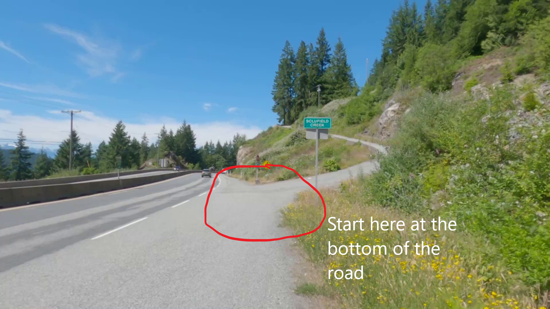
Start The VK starts at the bottom of a side access road marked by a sign that says "Sclufield Creek" on the opposite side of the Sea to Sky highway to the Sunset Marina (at Lawrence way). You can park either at the free carpark (6-7 shady spots) directly off the highway on Lawrence way (be careful crossing the highway to the VK start), or along the side access road heading up to the Sunset trail (there may be a couple of places you can park). The start of the VK begins AT THE BOTTOM of the access road right on the highway, not at the gate higher up the road, so if you park on the access road you will need to walk down to the highway to begin the VK climb (See Image #1).
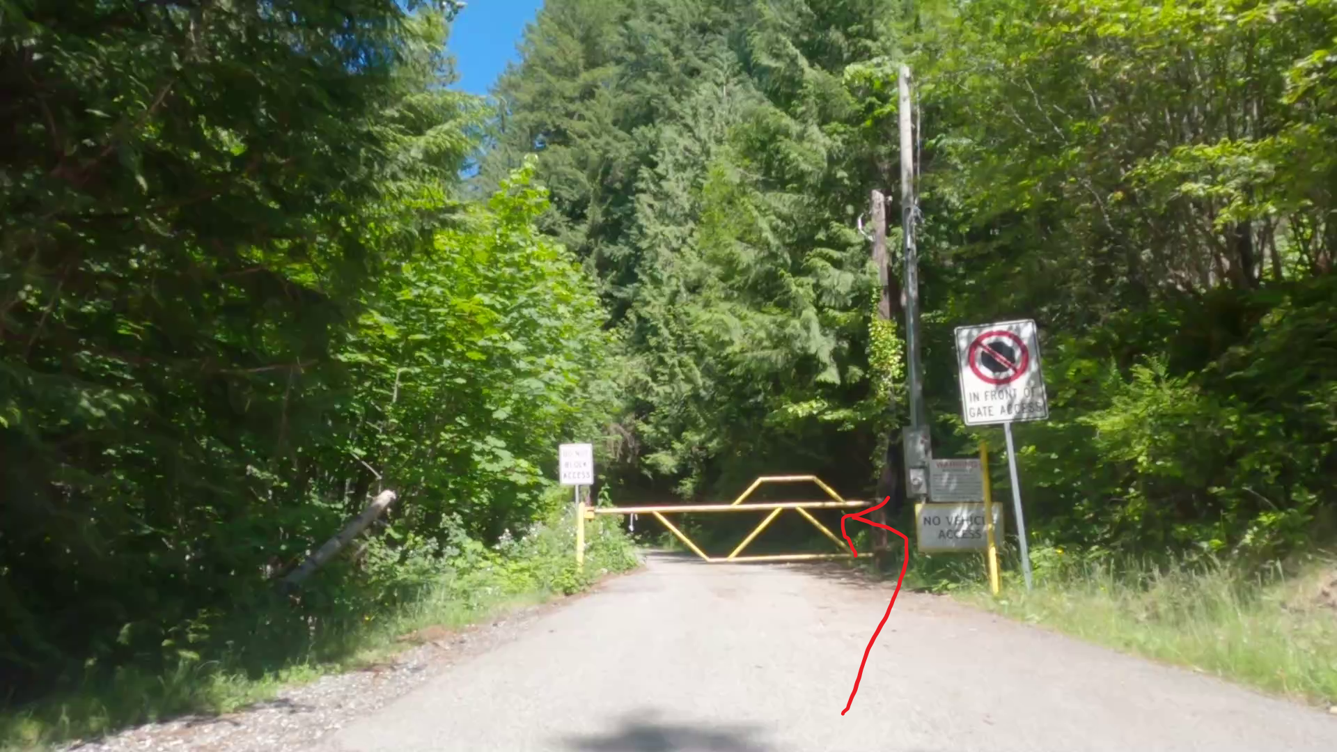
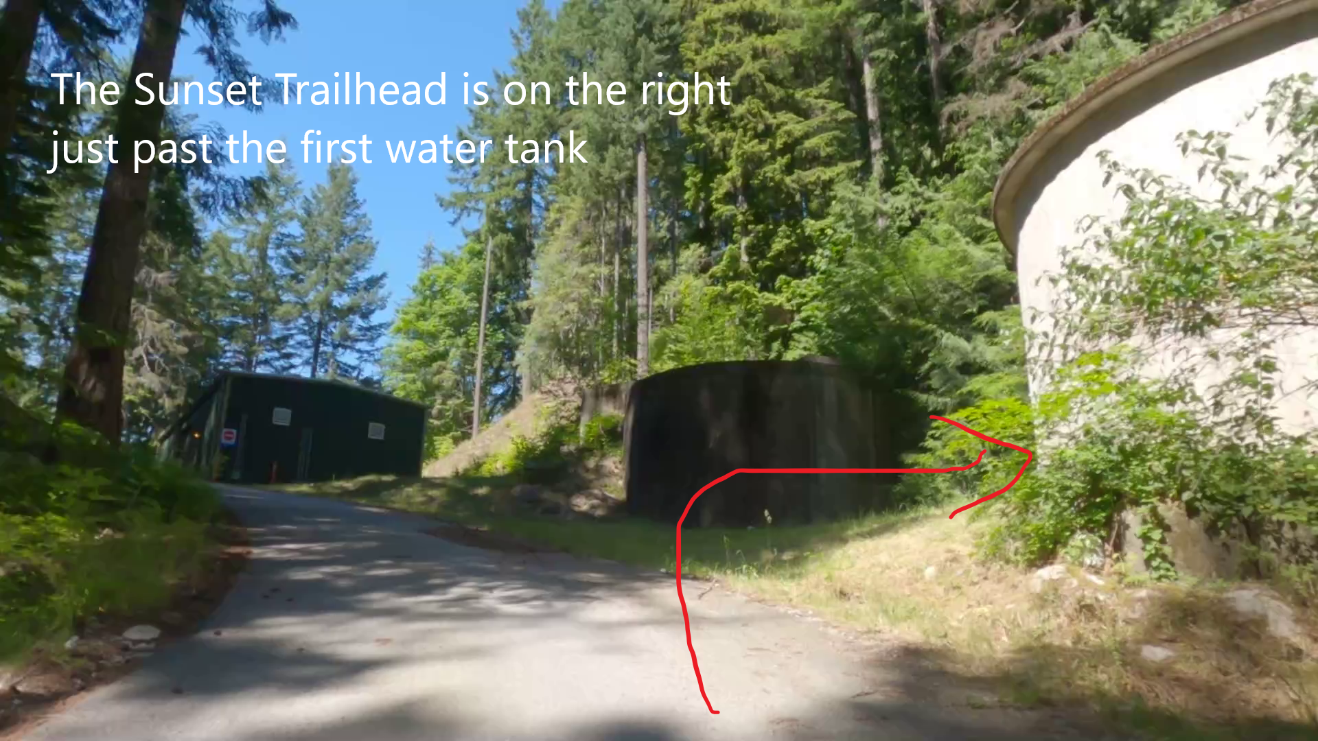
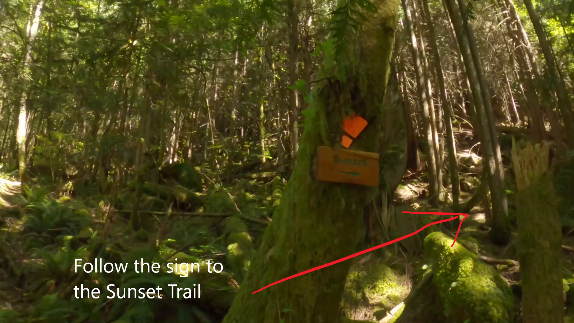
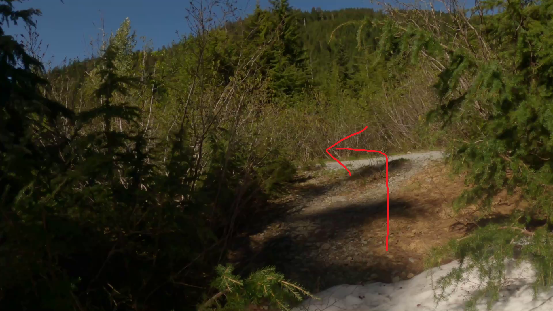
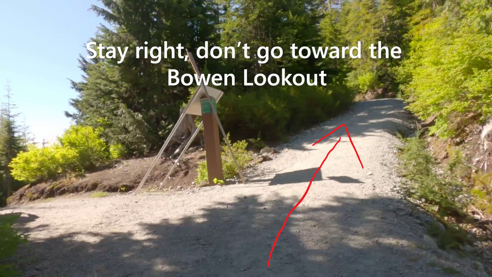
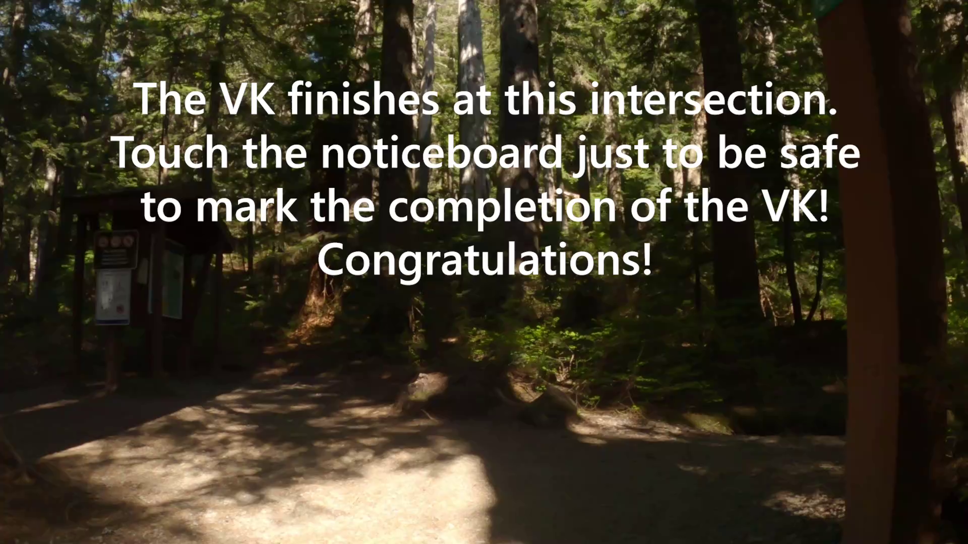
Navigating To find the Sunset trail, after passing the gate (See Image #2) about 100m up the gravel road you will come to two large water tanks (See Image #3). Look to your right when passing the first one on your right you will see an Orange diamond showing the trail entry. The trail is clearly marked and easy to follow. Early on there is a fork in the trail with a sign saying Sunset trail. Go right following the sunset trail. (See Image #4) Along the way there are a couple of potentially confusing spots. You will notice a sign to a viewpoint halfway up going left. Ignore this viewpoint (but certainly check it out on the way back down!). Eventually you will come to a flowing creek (the only water source on the run), and there is a fork in the trail with a sign saying "shortcut" (See Image #5). You can take either route as they both connect up together 100m up ahead, but please take the shortcut route for the fastest way. Eventually the Sunset trail connects up to the main walking route toward the Bowen Lookout (See Image #6). Turn left (but also pay attention to where you came out if you are returning down this trail to your car as the entry is not marked) and then follow the signs along the Howe Sound Crest West trail. Eventually you will come to a fork where on the left will be Bowen lookout (See Image #7). Don't go left, but go right to continue on the Howe Sound Crest West trail, and up several switchbacks before you reenter the forest and connect to the Howe Sound Crest East Trail, with a large noticeboard (See Image #8). The finish of the course is touching the noticeboard.
Finish The course finishes at the noticeboard on the Howe Sound Crest Trail where the Howe Sound Crest trail West merges with the Howe Sound Crest Trail East. The Howe Sound Crest Trail west passes the Bowen Lookout.

Video Demonstration
Description
Note: Afterglow replaces the originally intended VK2 course called "Black Swan". Due to risk of landslide, the access to the swan falls trail is closed and is unlikely to open this summer according to the Buntzen Lake warden (as of June 24th). We have decided to replace this course with Afterglow for 2021. While it is not as steep and longer in distance, Afterglow is a great addition to the series and we are sure competitors with enjoy this route!
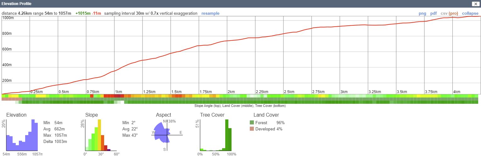
Afterglow is a VK course that starts up the Sunset Trail which is a well-marked and technically easy-moderate trail that heads up to Yew Lake at Cypress and connects onto the Howe Sound Crest West access Trail. The course finishes where this trail connects to the Howe Sound Crest trail East (the noticeboard) before you continue on to St Marks summit.
Runners will need to carefully pace their effort on this course, with the steepest section coming early into the climb, with a steady ascent along the trail navigating beneath or around a few fallen trees. Eventually you reach a creek where the trail begins to lessen in steepness as you carry on toward the Yew Lake area on cypress, before a final push up the sun-exposed switchbacks of the Howe Sound Crest trail to the finish.
Parking and Access You can park either at the free carpark (6-7 shady spots) directly off the highway on Lawrence way (be careful crossing the highway to the VK start), or along the side access road heading up to the Sunset trail (there may be a couple of places you can park). This VK course has the option of car-pooling so you don't have to run down the trail back to your car. Get someone to park at the Cypress ski resort, and another to park down at the Sunset trailhead. After your VK attempt you will only have a brief 2km downhill jog back to your car. You can also take a bus from Horseshoe bay to stops along the Sea to Sky highway for the Sunset Marina - however the bus only stops on the southbound direction, so you'll need to stay on the bus up to Brunswick beach and then get off on the way back toward Horseshoe Bay (its a loop service). Make sure you tell the driver where you want to get off (The Sunset Marina) so he/she knows where to stop for you. If you ask they might be ok with dropping you at Sclufield creek access road on the Northbound direction.
RunGo APP
Profile
The Vancouver VK Series is Proudly Sponsored by Bremner's Foods a local Vancouver based company.
Check out their premium products on Bremners Online at:
www.bremnerfoods.com