Vancouver VK Courses - VK6 Pins and Needles
Headwaters Group
Headwaters Vertical KM Course #2CLOSED
Course is Currently CLOSEDLeaderboards
View Leaderboards for VK6Start and Finish Instructions
Strava Segment: https://www.strava.com/segments/28991950
Download GPX File: vk6-pins-and-needles.gpx
Warning: There is no water on this route (please take 2L minimum on a hot day), as it is really dry and can get really hot up on the Lynn peak and Needles ridgeline. I highly recommend you descend via hydraulic rather than attempt the long journey along to South Lynn Peak and down the Lynn grind to Lynn valley. The loop back to the car this direction is 19km but it will take you probably 2-3 hours after your VK attempt as it is very slow going along the ridgeline, so you will need a lot of water on a hot day (trust me). Going down hydraulic seems longer but it will be faster to get back to a water source.
Accessing the Route: This is a backcountry route which means you must commute to the start of the VK course. It is ~6-6.5km run from the Lower Seymour Conservation Reserve parking. You can either bike to the start via Fishermans trail or the Seymour Valley Trail, or run.
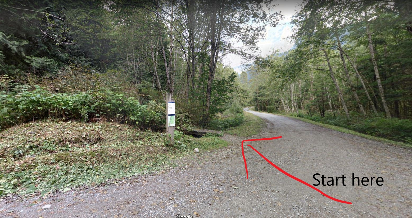
Start: The VK starts at the base of the Hydraulic Connector trail on the intersection of Fishermans Trail and the Spur4 access road. There is a small wooden bridge and a wooden gate with a trailhead sign marking the start (see images #1 and #2.
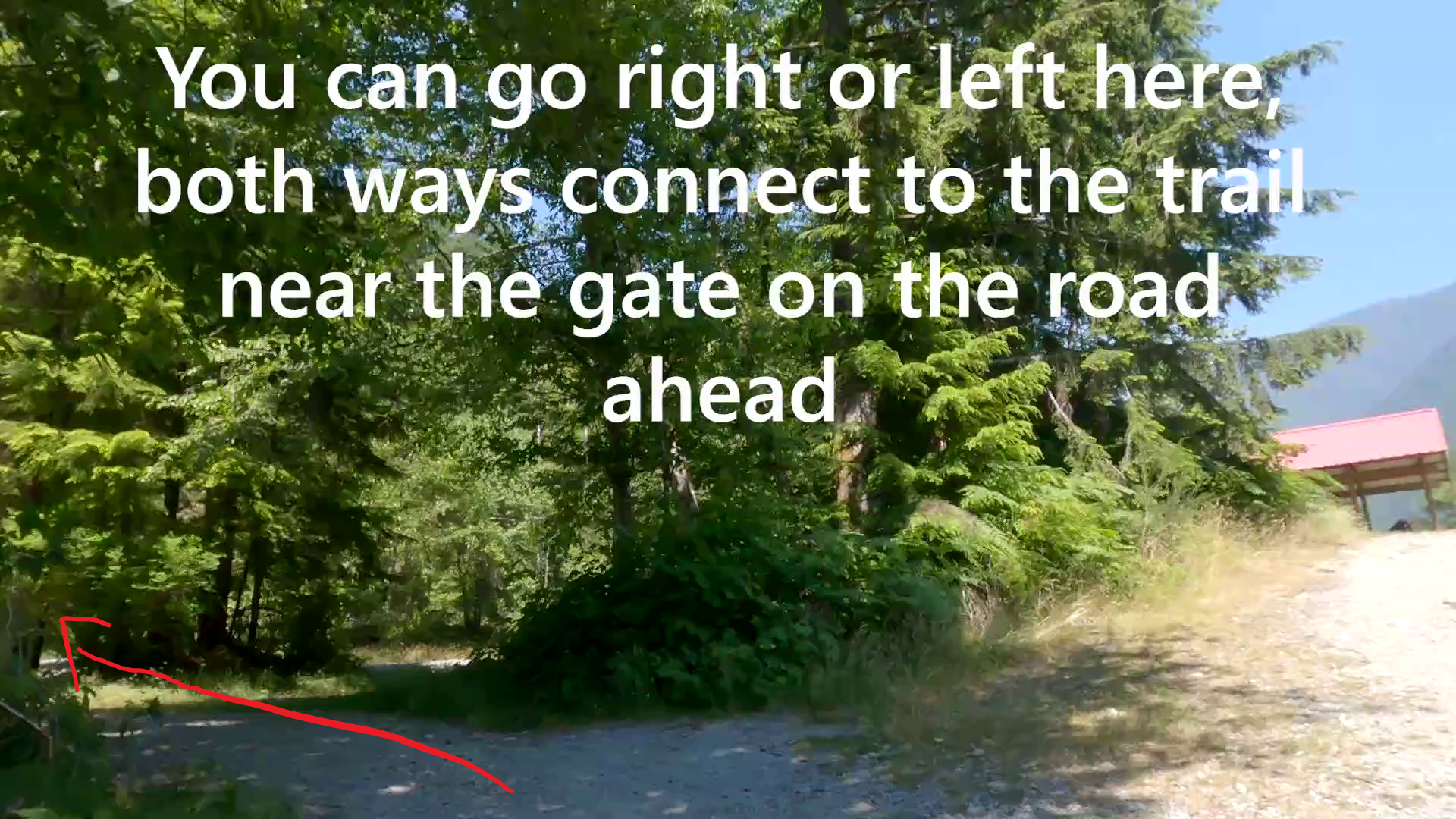
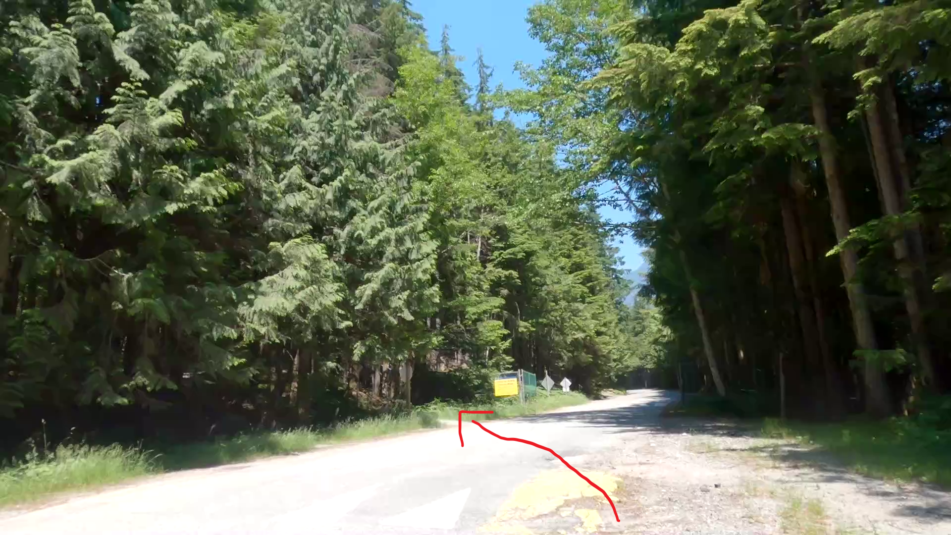
You begin the climb and shortly thereafter ~300m you come to another road with a lookout picnic area. You can take either left or right fork in the trail and both connect up ahead on the road (I recommend you go left since thats where the strava segment goes). The trail continues on once you cross the road (just before the fence see image #3 and #4)

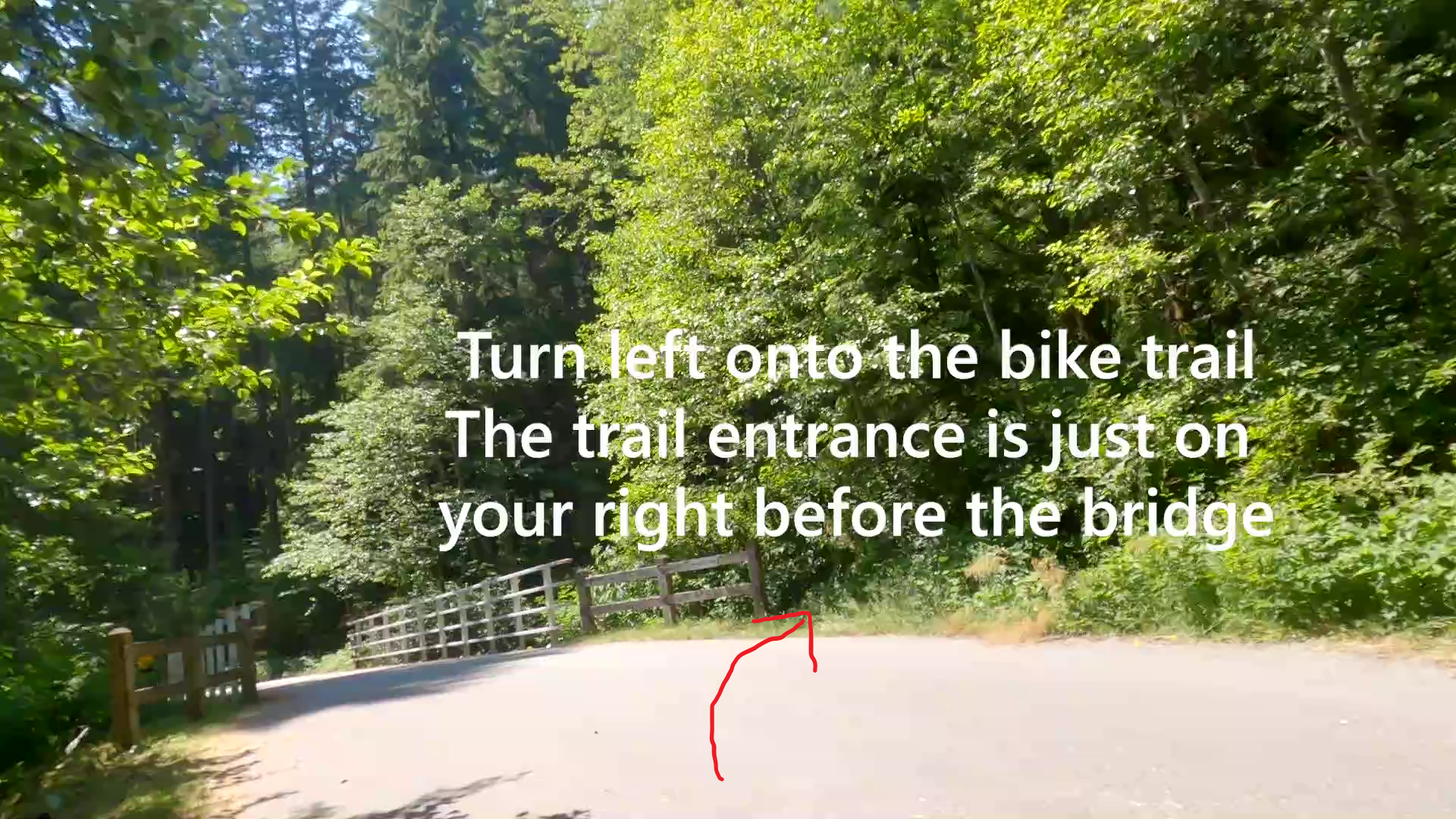
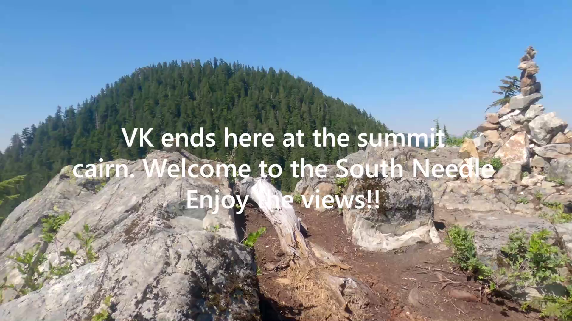
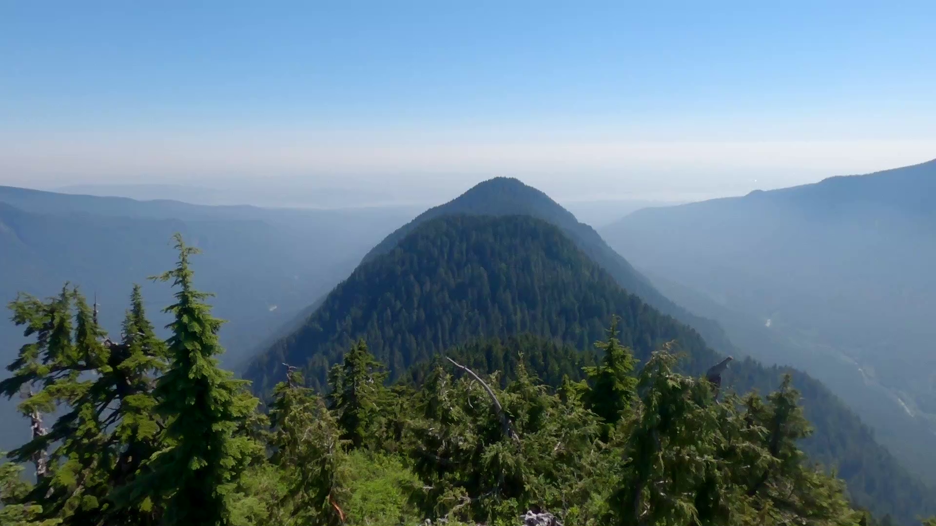
The trail then goes up another 800 meters where you will cross the Seymour Valley bike trail (asphalt road). Take a left here. The Hydraulic trail begins just before the bridge. You will see the bridge with a sign saying "Hydraulic Creek", the trail is just before the bridge (See Image #5). The trail is easy enough to follow but slow going due to technicality and obstacles. You climb for 2km ascending 660m before you eventually reach the T-Intersection with the trail going along the backbone of the Lynn Peak-Needles ridgeline. (See Image #6) You turn right and follow the signs to the South Needle peak. The climb up to South needle is only 1km but it is quite deceptive, as you will climb around the right of a false summit and other a bunch of fallen trees climbing about 350m ascent, eventually coming out onto sun exposed rocky peak of South Needle with some reasonably easy rock scrambling. The end of the VK is the rock cairn on top of the peak. (See Image #7) Enjoy the great views!

Video Demonstration
Description
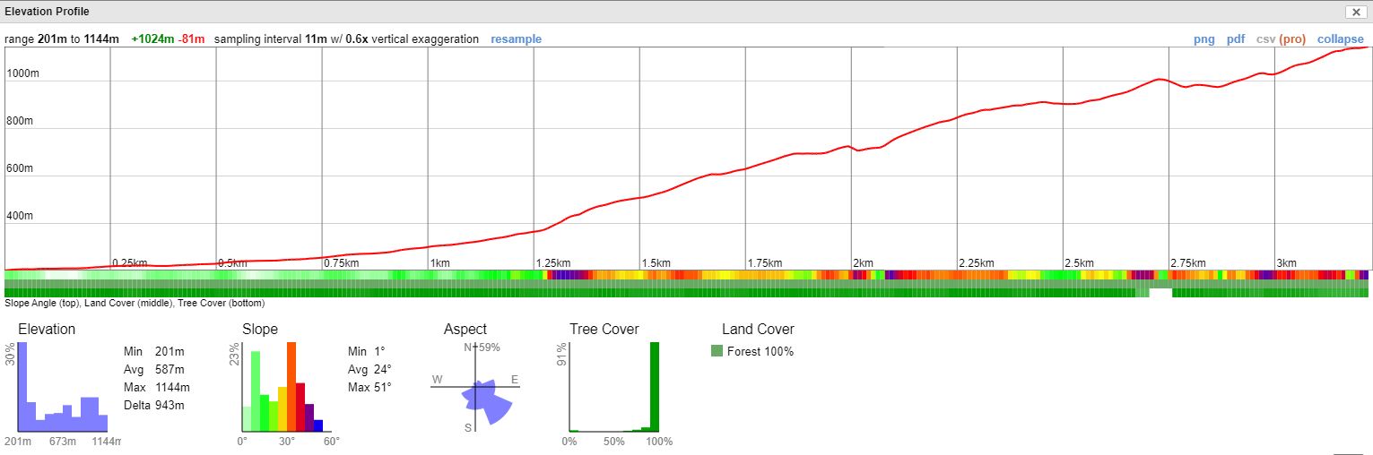
This course begins in the Seymour Valley at the start of the Hydraulic connector and heads directly up to Lynn Peak and the Needles. The first 1.25km is not especially steep but then it quickly ramps up with a very steep section featuring 50% grades, then a steady climb with 30-40% grades. The course completes nearby the summit of the South Needle.
RunGo APP
Profile
The Vancouver VK Series is Proudly Sponsored by Bremner's Foods a local Vancouver based company.
Check out their premium products on Bremners Online at:
www.bremnerfoods.com